 VOYAGES TRAVELS EXPLORATIONS
— PLACES —
(Imaginary Travels are gathered under "IMAGINARY")
 VOYAGES TRAVELS EXPLORATIONS
 A Politician's Prose & Poetry — Presentation Copy
  Everhart, James B. Miscellanies. West Chester, PA: Edward F. James, 1862. 8vo. Frontis., [6], ii, 300 pp.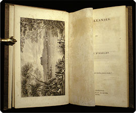
 travelogues,
and musings from James Bowen Everhart, a member of the Pennsylvania State Senate
1876–83 and the U.S. House of Representatives 1883–87.
travelogues,
and musings from James Bowen Everhart, a member of the Pennsylvania State Senate
1876–83 and the U.S. House of Representatives 1883–87.
Provenance: Inscribed by the author: “To B.F. Pyle, Esq. [?] from his friend the author.”
• Publisher's textured violet cloth, spine with gilt-stamped title; faded, especially over spine, tear to cloth along front joint with corners and extremities a bit rubbed. Front fly-leaf with inked inscription as above. Endpapers, frontispiece (“The Rhine”), and title-page lightly foxed. In fact a clean, nice copy. (23195)

 The
Andes toANTARCTICA
— 78 Plates
/ 5
Maps
Famin, César, et al. L'univers, ou histoire et description de tous les peuples. Amérique méridionale, iles diverses de l'océan et régions circompolaires. Chili, Paraguay, Uruguay, Buenos-Ayres...Patagonie, Terre-du-Feu et Archipel des Malouines...iles diverses des trois océans et régions circompolaires. Paris: Firmin Didot Frères, 1840. 8vo (21.5 cm, 8.4"). [4], 96, 64, 91, [1], 328 pp.; 76 plts., 5 fold. maps, 2 single-f. maps.
The
Andes toANTARCTICA
— 78 Plates
/ 5
Maps
Famin, César, et al. L'univers, ou histoire et description de tous les peuples. Amérique méridionale, iles diverses de l'océan et régions circompolaires. Chili, Paraguay, Uruguay, Buenos-Ayres...Patagonie, Terre-du-Feu et Archipel des Malouines...iles diverses des trois océans et régions circompolaires. Paris: Firmin Didot Frères, 1840. 8vo (21.5 cm, 8.4"). [4], 96, 64, 91, [1], 328 pp.; 76 plts., 5 fold. maps, 2 single-f. maps. 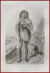
 For Books for the BUSTED

Fremont's Third Expedition Frémont, John Charles. Geographical memoir upon upper California, in illustration of his map of Oregon and California. Washington: Printed by Tippin & Streeper, 1849. 8vo (23.5 cm; 9.25"). 40 pp.
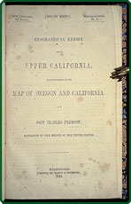
 Click the image to the right for an enlargement.
 Here Frémont presents to the U.S. Senate his formal report on his third expedition to the West. The map referred to in the title was issued separately under title “Map of Oregon and Upper California. . . 1848" and is not present; hence the affordable price here.
 The original edition, not a reprint. A government publication: [U.S.] 30th Cong., 2d sess. House. Misc. [doc.] 5.
• Sabin 25837; Howes F366; Wagner-Camp-Becker, Plains and Rockies, 150:2. Recent marbled paper–covered boards with leather label on front cover. Occasional light foxing. (24883)

“The Yaks are Strong & Hardy” Gerard, Alexander. Account of Koonawur in the Himalaya,
etc. etc. etc. London: James Madden & Co., 1841. 8vo (23 cm, 9"). xiii, [3], 190, [2], [195]–308 (i.e.,
310), xxvi, [2 (adv.)] pp.; 1 fold. map.
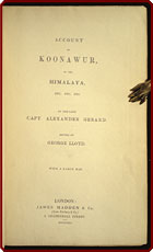
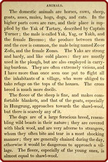
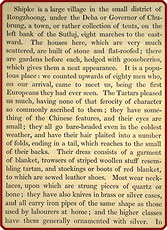 Click the interior images for enlargements.
 Gerard's observations cover botany, linguistics, culture, and commerce, as well as geography. The area of his travels is depicted by an oversized, folding map of his own design.
• NSTC 2G5453; Howgego, II, G7. Contemporary brown cloth, spine with gilt-stamped title; rebacked and 95% of original spine reapplied, with the publisher's name at the foot of the spine chipped. Front pastedown and back of map each with institutional rubber-stamp (no other markings), front free endpaper with inked ownership inscription dated [18]49. Hinges (inside) reinforced. Last preface page with small inked annotation. Pages slightly age-toned; map with light offsetting and one short tear starting along fold, not touching image. (24291)

Still
a Most Interesting
“Read” —
An Edinburgh Edition
Hall, Basil. Extracts
from a journal, written on the coasts of Chili, Peru, and Mexico, in the years
1820, 1821, 1822. Edinburgh: Archibald Constable & Co. and Hurst, Robinson,
& Co., 1826. 12mo (14.5 cm, 5.75"). Add. engr. t.-p., xii, 313, [1 (blank)],
add. engr. t.-p., x, 311, [1] pp. (lacking map).
Interesting
“Read” —
An Edinburgh Edition
Hall, Basil. Extracts
from a journal, written on the coasts of Chili, Peru, and Mexico, in the years
1820, 1821, 1822. Edinburgh: Archibald Constable & Co. and Hurst, Robinson,
& Co., 1826. 12mo (14.5 cm, 5.75"). Add. engr. t.-p., xii, 313, [1 (blank)],
add. engr. t.-p., x, 311, [1] pp. (lacking map).
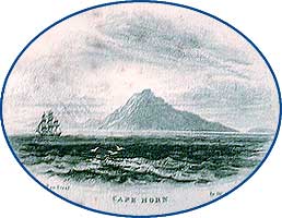
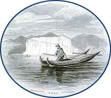
Hall's journal was first published in 1824; the present fifth edition was the second volume issued in the "Constable's miscellany of original and selected publications in the various departments of literature, science, & the arts" series. The text has been expanded from the second edition.
• Sabin 29718; Palau 112072 (first ed.). Contemporary half calf over marbled paper sides, spine ruled in double gilt fillets with gilt-stamped devices in compartments; worn and abraded with leather cracking over spine, and joints cracked but holding, Lacking map. Front free endpaper with inked ownership inscription. First and last few pages lightly spotted.
Virginia Discovery inLimited Edition Facsimile Hariot, Thomas. A briefe and true report of the new found land of Virginia ... reproduced in facsimile from the first edition of 1588. New York: Dodd, Mead & Co., 1903. 4to (23 cm, 9.1"). xiii, [1], [48] pp.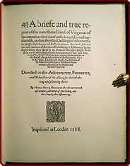
 Click the image for an enlargement.
 • Publisher's green cloth, front cover and spine with gilt-stamped title; corners and spine extremities a little rubbed, spine with white-inked call number. Front pastedown with institutional bookplate, no stamps or other markings; clean and nice. (24657)


The Amazon & Its “Aborigines” — 52 Lithographed PlatesHerndon, William Lewis; & Gibbon, Lardner. Exploration of the valley of the Amazon, made under direction of the Navy Department.... Washington: Robert Armstrong, 1853, & A.O.P. Nicholson, 1854. 8vo (23.2 cm, 9.1"). 2 vols. I: 414, [2], iii, [1] pp.; 16 plts. II: x, [2], 339, [1] pp.; 36 plts.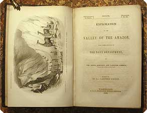
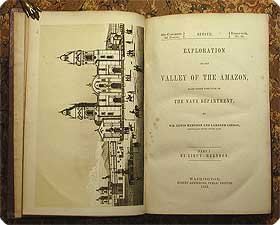 Click the images for enlargements.
 Many of the 52 lithographed plates are in duotone; some were done by Ackerman Lithography and some by P.S. Duval & Co., after views of scenery, buildings, and natives drawn by Lieut. Gibbon.
• Sabin 31524; Palau 113897. Publisher’s textured cloth, covers blind-stamped, spine with gilt-stamped title; vol. I with spine sunned and cloth chipped at spine extremities; vol. II with corners bumped, cloth peeling away from spine and chipped at spine extremities, spine with gilt dimmed and small area of unobtrusive discoloration from now-absent label. Front pastedowns each with pencilled owner’s name and institutional rubber stamp (no other markings); front free endpaper of vol. II starting to tear along inner margin. Mild to moderate foxing and spotting; a few text gatherings unopened. One plate in vol. I with short tear from outer margin, turning into a narrow scrape extending about halfway into the upper portion of the image; one leaf in vol. II with tiny portion (less than one word) affixed to opposing plate. Not a perfect set, but a perfectly fascinating one.
 For more SETS, click here.

 TO Part
III TO Part
III |